TRIMBLE CUSTOMER STORY
WHITNEY
BROUSSARD
Senior Scientist, JESCO, Inc. | Louisiana, USA

Making maps became a lifelong passion project
Ask Whitney Broussard what drew him to the geospatial industry, and he’ll tell you: “Making maps.”
On a field assignment in the foothills of the Colorado Rocky Mountains, Whitney watched a creek flowing and wondering where it went. He learned that the creek flowed into two different rivers that connected the Mississippi River, which courses through his home state more than 1,000 miles away.
That was an “a-ha” moment about how interconnected and vulnerable watersheds are. That next year, he moved home, enrolled in a GIS class, and saw the power and potential of visualizing that interconnectedness by mapping watersheds and landscape relationships in a spatial context
He was hooked.
 Protecting the Louisiana land he loves
Fast forward 17 years. After one GIS Masters, one PhD in Coastal Science, and many years of geospatial research and consulting, in 2017 Whitney joined JESCO, an environmental and geotechnical services firm in Jennings, LA, as the company’s only geospatial scientist. The move was a fitting choice for him because it would allow him to make a living from the Louisiana land he loves while helping protect his state at the same time.
“I genuinely care about this place, about the land, about the people, and I want to leave it better than I found it,” he says. “As a geospatial scientist, I get to help my clients answer their questions of where, why, and how through the detailed geospatial data and spatial analyses that I provide. It’s incredible to be a part of the ecological solution, particularly in Louisiana.”
Using technology to support nature-improving initiatives
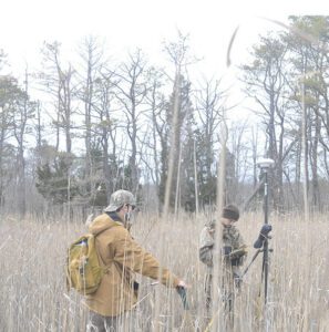
Driven to constantly improve, his work allows him to scratch that R&D itch and use technology to help support ambitious, nature-improving initiatives. And as a project manager, he juggles a lot of them-at present he has eight large, active projects.
Equally gratifying in all these geospatial-related projects are new business revenues made possible by Whitney’s in-house geospatial expertise.
 Making his mark by restoring the Louisiana coast for future generations
When it comes to making his mark in and out of the office, Whitney is programmed to think of the long game. Mindful of a former mentor, who said, “If you’re thinking about a problem you can solve in your lifetime, you’re thinking too small.” This is what motivates him to mentor and train the next generation to be better than him, to educate his clients one project at a time, and to work towards the regional goal of repairing and restoring the unique Louisiana coast.
It was a love of maps that plotted Whitney’s career path, and he’s been following it like he was born to do it. Grateful that he’ll never be bored, he sees endless possibilities to capitalize on the power of geospatial technology and the information it provides. Most importantly, he appreciates that his work is leaving an affirmative impact on the land he loves, and one that his family has loved and enjoyed for 250 years.

